Lake Huron

 images
Lake Huron (French: Lac Huron) is one of the five Great Lakes of North America. Hydrologically, it comprises the easterly portion of Lake Michigan–Huron, having the same surface elevation as its westerly counterpart, to which it is connected by the 5-mile-wide (8.0 km), 20-fathom-deep (120 ft; 37 m) Straits of Mackinac. It is shared on the east by the Canadian province of Ontario and on the west by the state of Michigan in the United States. The name of the lake is derived from early French explorers who named it for the Huron people inhabiting the region. The huronian glaciation was named due to evidence collected from Lake Huron region. The northern parts of the lake include the North Channel and Georgian Bay. The main inlet is the St. Marys River and the main outlet is the St. Clair.

Lake Michigan,


Lake Michigan is one of the five Great Lakes of North America and the only one located entirely within the United States. The other four Great Lakes are shared by the U.S. and Canada. It is the second-largest of the Great Lakes by volume[1] and the third-largest by surface area, after Lake Superior and Lake Huron (and is slightly smaller than the U.S. state of West Virginia). To the east, its basin is conjoined with that of Lake Huron through the wide Straits of Mackinac, giving it the same surface elevation as its easterly counterpart; the two are technically a single lake.[4] Lake Michigan is shared, from west to east, by the U.S. states of Wisconsin, Illinois, Indiana, and Michigan. The word "Michigan" originally referred to the lake itself, and is believed to come from the Ojibwa word mishigami meaning "great water".[5] Lake Michigan is also the only one of the five Great Lakes not to share a shoreline with the Canadian province of Ontario, the only province in Canada that borders the Great Lakes.

Lake Erie,


Lake Erie[5] (/ˈɪri/; French: Lac Érié) is the fourth largest lake (by surface area) of the five Great Lakes in North America, and the thirteenth largest globally if measured in terms of surface area.[6][1] It is the southernmost, shallowest, and smallest by volume of the Great Lakes[7][8] and therefore also has the shortest average water residence time. Lake Erie's northern shore is bounded by the Canadian province of Ontario, with US states of Ohio, Pennsylvania and New York on its southern and easternmost shores and Michigan on the west. The lake was named by the Erie tribe of Native Americans who lived along its southern shore. That Iroquoian tribe called it "Erige" ("cat") because of its unpredictable and sometimes violently dangerous nature.[7] It is a matter of conjecture whether the Lake was named after the tribe, or if the tribe was called "Erie" because of its proximity to the Lake.

Pandoh Lake,

Pandoh Dam is situated in Mandi district and created by Pandoh Dam. The lake is the reservoir of the dam which has been targeted at the generation of hydroelectric generation. The lake diverts the water from River Beas and pours it into the River Satluj. The dam is under Bhakra Beas Management Board (BBMB) and the road built over the dam is a part of NH 21. The Beas water is diverted and through tunnels taken to Salapad (around 40 km from here)where water is used to generate electricity along with the water of Satluj.


Nako Lake,


Nako Lake is a high altitude lake in the Pooh sub-division of district Kinnaur. It forms part of the boundary of Nako village and seems that the village is half buried in the lake's border. It is about 3,662 metres (12,014 ft) above sea level. The lake is surrounded by willow and poplar trees. Near the lake there are four Buddhist temples. Near this place there is a footlike impression ascribed to the saint Padmasambhava. Several miles away there is a village called Tashigang around which there are several caves where it is believed that Guru Padmasambhava meditated and gave discourse to followers. There is a waterfall nearby which has snow water falling like a river of milk. Legend says that it is a heavenly realm of fairies. In one of the caves you are still able to see the live footprints of these fairies or other demigods. It is a sacred place for the people of these valleys. Followers come from as far a place as Ladhak and spiti valley


Mir Alam Tank Lake,


Mir Alam Tank is a reservoir in Hyderabad, Telangana, India. It is located to the south of Musi river. It was the primary source of drinking water to Hyderabad before Osman Sagar and Himayat Sagar were built. It is connected to National Highway7 near Palm Valley.

Kukkarahalli lake

Kukkarahalli Lake also called Kukkarhalli Kere (Lake is ‘’kere’’ in local Kannada language), located in the heart of the Mysore city, adjoins the Manasgangotri (University of Mysore),[1] the Kalamandir (Rangyana) and the Central Food Technological Research Institute (CFTRI) campus (separated by the Hunsur Road). It provides lung-space to the city. Mummadi Krishnaraja Wodeyar, (1794–1868) of the Mysore Dynasty (Kingdom of Mysore) was responsible for getting the lake created, in the year 1864, to provide water for irrigation to about 4000 ha (10,000 acres) of land outside the city.[2] The Lake also used to be a source of water supply to the city of Mysore but over the years, sewage and excessive land encroachments (mostly illegal) and blockage of water flow sources almost led to the eutrophication of the lake. The University of Mysore and the citizen forums of Mysore continue to make efforts to preserve the lake by implementing several remedial measures.


Dal Lake,

Dal Lake is a small mid-altitude lake (1,775 m above sea level) near the village of Tota Rani in Kangra district (Himachal Pradesh) in northern India. The name 'Dal Lake' is taken from Kashmir's Dal Lake.

The lake is surrounded by deodar trees and is considered to be a sacred spot as there is small Shiva mandir (shrine) on its bank. There are different kinds of fish that live in this lake. The lake has greenish water.

Kodaikanal Lake


\
Kodaikanal Lake, also known as Kodai Lake is a manmade lake located in the Kodaikanal city in Dindigul district in Tamil Nadu, India. Sir Vere Henry Levinge,[1] the then Collector of Madurai, was instrumental in creating the lake in 1863, amidst the Kodaikanal town which was developed by the British and early missionaries from USA.[2][3] The lake is said to be Kodaikanal's most popular geographic landmark and tourist attraction.

Over the years a boat club, boathouse and boat service (with rowing boats and pedalling boats and a public ferry) for the public and tourists has become fully functional and is of aesthetic significance for tourism. Boat Pageant and Flower Shows are a regular feature in the summer season which attracts tourists.

Palak Dil,


Palak Dil or Pala Tipo (Mara language for "swallowing lake") is the largest lake in southern Mizoram, northeast India. It is located in near Phura village in Saiha district, within the Mara Autonomous District Council. Its geographical location falls under the Indo-Burma biodiversity hotspot, and is therefore rich in animal and plant species. The lake is a major component of the Palak Wildlife Sanctuary,[1] and it supports the major biodiversity of the sanctuary.[2]

Pala is derived from a mythical Mara story for the name of the lake while tipo means "lake"; it is called Palak Dil in Mizo ṭawng. The lake gives the name of the region Palak Assembly Constituency under Election Commission of India.


Shamirpet Lake

Shamirpet Lake is an artificial lake near Hyderabad, India, about 24 kilometers north of Secunderabad. It was built during the Nizam reign.

The lake attracts many birds, making it a good birdwatching spot. A resort run by the Government of Andhra Pradesh is located near the lake. The Outer Ring Road will pass close to the lake.[1] There are many resorts and Private Dhabas around the lake.You can also visit The famous Celebrity Club and the 4 star Alankrita Resort are not very far from the lake. The prestigious Birla Institute of Technology and Science, Pilani – Hyderabad Campus is also situated near the lake.[2][3] Today, the pond offer boating facilities[4]

There is a Jawahar Deer Park, which contains many deer, peacocks and different Birds, is also near to the lake. The Deer park is maintained by the Government of Andhra Pradesh.[5]

Many people go there for a picnic or a get together. Many Telugu Films were shot there.

The Shamirpet Police takes care of the lake as there were many cases regarding drowning of people in this lake. There are many Warning Boards around the lake erected by the Authorities.[6]

The Nalsar University of Law[7] is also situated near the lake, which is one of the top Law schools of India.

Ashtamudi Lake

images

Ashtamudi Lake (Ashtamudi Kayal), in the Kollam District of the Indian state of Kerala, is the most visited backwater and lake in the state. It possesses a unique wetland ecosystem and a large palm-shaped (also described as octopus-shaped) water body, second only in size to the Vembanad estuary ecosystem of the state. Ashtamudi means 'eight coned' (Ashta : 'eight'; mudi : 'coned') in the local Malayalam language. The name is indicative of the lake's topography with its multiple branches. The lake is also called the gateway to the backwaters of Kerala and is well known for its houseboat and backwater resorts.[1][2][3] Ashtamudi Wetland was included in the list of wetlands of international importance, as defined by the Ramsar Convention for the conservation and sustainable utilization of wetlands.

Harike Wetland


Harike Wetland also known as "Hari-ke-Pattan", with the Harike Lake in the deeper part of it, is the largest wetland in northern India in the Tarn Taran Sahib district[1] of the Punjab state in India.

The wetland and the lake were formed by constructing the headworks across the Sutlej river, in 1953. The headworks is located downstream of the confluence of the Beas and Sutlej rivers. The rich biodiversity of the wetland which plays a vital role in maintaining the precious hydrological balance in the catchment with its vast concentration of migratory fauna of waterfowls including a number of globally threatened species (stated to be next only to the Keoladeo National Park near Bharatpur) has been responsible for the recognition accorded to this wetland in 1990, by the Ramsar Convention, as one of the Ramasar sites in India, for conservation, development and preservation of the ecosystem.

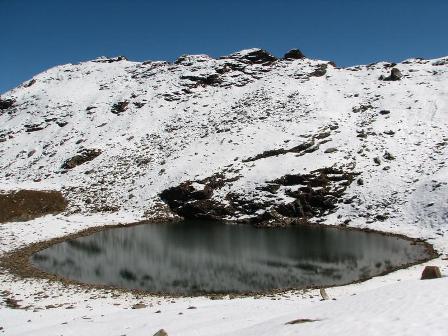
Brighu Lake,


Brighu Lake is a high altitude lake which is located in the district Kullu. It is about 4,235 m above the sea level. It lies east of the Rohtang Pass and is about 6 km from the village of Gulaba. This lake is held sacred to the sage, Brighu. It lies on the various trek routes of the region.[1] This lake is the holy place of Brighu Rishi, a great saint of Indian history

Rajsamand Lake


Rajsamand Lake is one of the five popular lakes of Mewar. Located 66 km in the north of Udaipur, Rajsamand Lake lies between the cities of Rajnagar and Kankroli. It is also known by the name of Rajsamudra Lake in Rajasthan. Rajsamand Lake was built by Maharana Raj Singh in 1660.


Osman Sagar Lake


Osman Sagar popularly known as Gandipet, is a reservoir in the Indian city of Hyderabad. The lake is around 46 km², and the reservoir is around 29 km².
History
Osman Sagar was created by damming the Musi River in 1920, to provide an additional source of drinking water for Hyderabad and to protect the city after the Great Musi Flood of 1908. It was constructed during the reign of the last Nizam of Hyderabad, Osman Ali Khan, hence its name.

A princely guest house called Sagar Mahal, overlooking the lake and now a heritage building, was built as a summer resort of the last Nizam. Its location on the banks of the lake offers wonderful views. Telangana Tourism Department [1] operates a resort in the building. The breeze of the lake is very pleasant and has been popular with the locals since the Nizam's time.

Manasbal, lake


Manasbal Lake is located in Safapora area of Ganderbal District in the State of Jammu and Kashmir in India. The name Manasbal is said to be a derivative of the Lake Manasarovar.[2] Lake is encircled by three villages viz., Jarokbal, Kondabal (also called Kiln place, is situated on the north-eastern side of the lake) and Ganderbal and is stated to be the deepest lake (at 13 m or 43 ft depth) in India.[citation needed] The large growth of lotus (Nelumbo nucifera) at the periphery of the lake (blooms during July and August) adds to the beauty of the clear waters of the lake. The Mughal garden, called the Jaroka, (meaning bay window) built by Nur Jahan overlooks the lake.\

Nakki Lake,


'Nakki Lake is a lake situated in the Indian hill station of Mount Abu in Aravalli range.
History
It is a very ancient sacred Lake, according to the Hindu legend. It is called by this name because it was dug out from Nails (Nakh). One story is of dug by Gods to live in, for protection against the Bashkali rakshash (a wicked demon). While other is of Rasiya Balam (a sculpture of Dilwara Jain temple), who dug the lake, as the king told that whoever will dug the lake within one night I will marry my daughter to him. But later king's wife refused and he couldn't marry the king's daughter. Temple of Rasiya Balam and Kunwari Kanya (king's daughter)'s is located behind the Dilwara Jain temple.

Sasthamcotta Lake


Sasathamcotta Lake or Sasathamkotta Lake, also categorized as a wetland, is the largest fresh water lake in Kerala, a state of India on the south of the West Coast. The lake is named after the ancient Sastha temple (a pilgrimage centre) located on its bank. It meets the drinking water needs of half million people of the Quilon district and also provides fishing resources. The purity of the lake water for drinking use is attributed to the presence of large population of larva called cavaborus that consumes bacteria in the lake water.[1] The lake is a designated wetland of international importance under the Ramsar Convention since November 2002.

Dipor Bil,


Dipor Bil, also spelt Deepor Beel (Pron: dɪpɔ:(r) bɪl) (Assamese: দীপৰ বিল) (bil or beel means "lake" in the local Assamese language), is located to the south-west of Guwahati city, in Kamrup district of Assam, India[1] It is a permanent freshwater lake, in a former channel of the Brahmaputra River, to the south of the main river. It is also called a wetland under the Ramsar Convention which has listed the lake in November 2002, as a Ramsar Site for undertaking conservation measures on the basis of its biological and environmental importance.[1][2]

Considered as one of the largest beels in the Brahmaputra valley of Lower Assam, it is categorised as representative of the wetland type under the Burma monsoon forest biogeographic region.[3]

The Dipor Bil is reported to provide, directly or indirectly, its natural resources for the livelihood of fourteen indigenous villages (1,200 families) located in its precincts.[4] Freshwater fish is a vital protein and source of income for these communities; the health of these people is stated to be directly dependendent on the health of this wetland ecosystem. A member of Deepor Beel Fishermen’s Cooperative Society has succinctly stated

Popular Posts

Like us on Facebook

Flickr Images